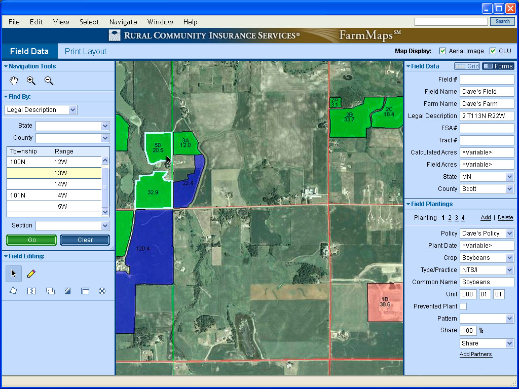
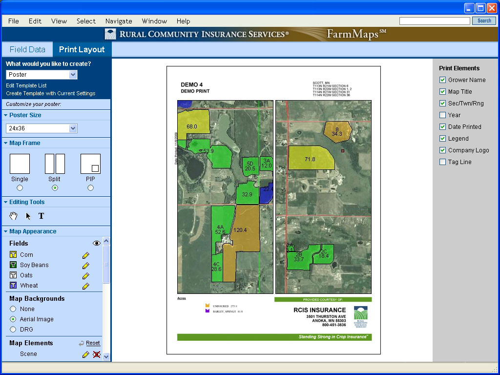
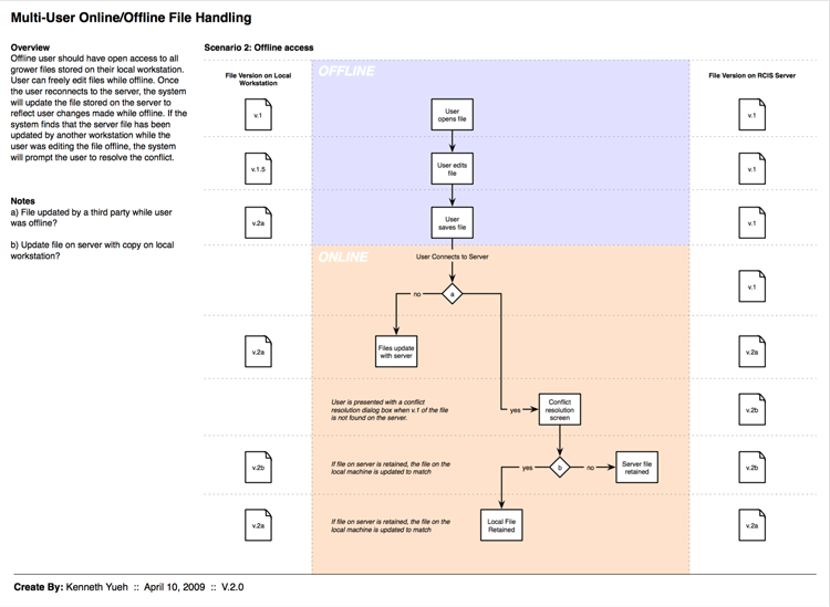
Mapping software created developed for Rural Community Insurance Services (RCIS) to meet the needs of crop insurance agents. The software allows agents to quickly identify a producer's fields and assign a crop type, simplifying the process of tracking crop yields from year to year.
Involvement: Strategy / Research / Sitemaps / Wireframes / Design